
Digital Terrain Model Including Building Height

Digital Terrain Model including building height is more accurate to process prediction coverage by Planet or Atoll software, help you to create more precision designs. The model of the earth’s surface by depicting all visible objects on the earth’s surface. Building objects covering the land and open land objects are included in the data. The […]
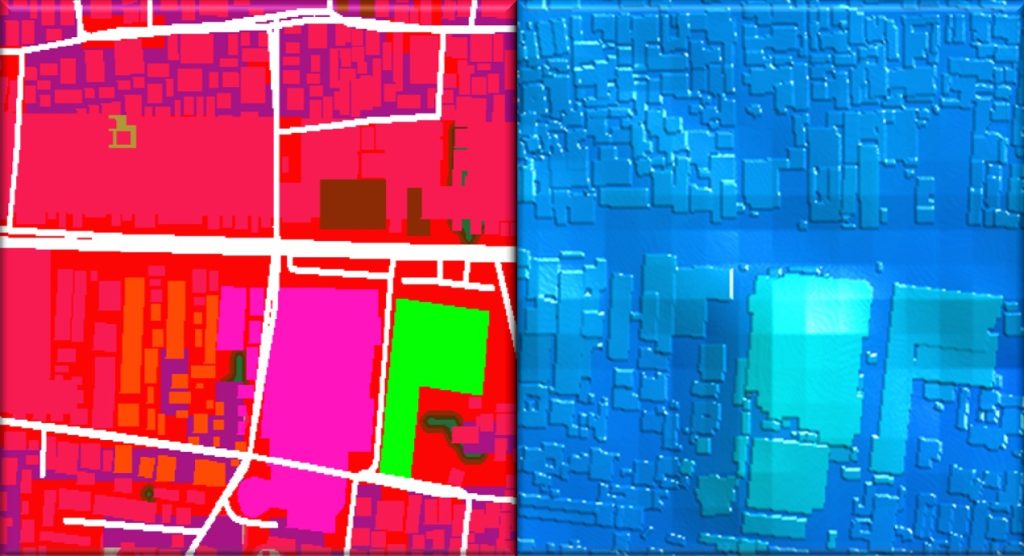
Building Height Map with Detail Value

Need a clear and reliable view of where your equipment location. With building height maps you will be able to know any obstacles due to buildings surrounding area. Deliver the best service improve customer satisfaction by ensuring reliable and consistent coverage everywhere dense, urban and rural area by knowing the building height. Our buildings map […]
Digital Map Distribution and Density Population Value

When you are planning telecoms infrastructure, You need a clear and reliable view of where your customers are. Use our population distribution and density maps to: oEmerging Markets from the world’s most populous islands to remote islands, our maps cover the entire Indonesian population. oDeliver the best service to improve customer satisfaction by ensuring reliable […]
Polygon Footprints for Planet or Atoll Software
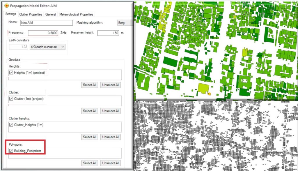
Get update polygon building footprints for support processing prediction coverage by Planet or Atoll software. Our building footprints are more completed than OSM map. Buildings shapes polygons are created using an automated production process of object recognition from high-resolution satellite images. And our distribution population polygon is a significant element for wireless network planning. Population […]
Clutter Grid for 5G/NR City Plan
5G networks provide increased speeds of signal and network capacity. However, the signal is susceptible to any obstacle due to the short propagation distance. Building can block a signal and should be taken into in the planning processing prediction coverage by Planet or Atoll software. With clutter class high resolution 1 x 1 meter plus […]
Tunning Result Comparison
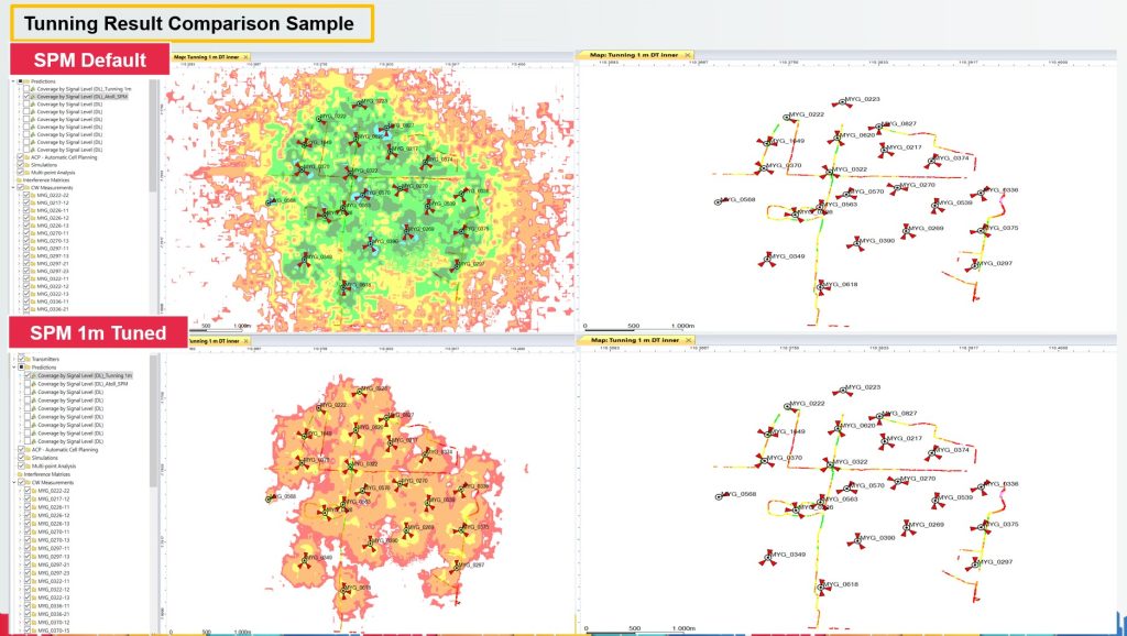
We conducted propagation tuning using Atoll software with the default Standard Propagation Model (SPM) settings and compared it to tuning with an SPM enhanced by a 1 meter resolution clutter map (as shown in the bottom image). The comparison revealed distinct differences in propagation results. Tuning with the 1 meter clutter map produced results that […]
